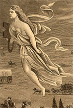
 CLICK TO ENLARGE 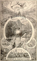 CLICK TO ENLARGE |
"The American West" has always been at
least as much an idea as a place. When Sam Clemens went
west for the first time in the early 1860s, the
landscapes and people he encountered had already been
depicted in thousands of pictures and millions of
words. And when MT wrote about that experience in the
early 1870s, his text and its illustrations became yet
another means by which American society worked to come
to terms with the "newest" portions of its "new world."
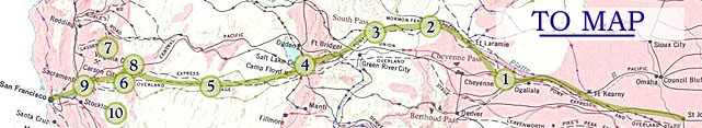
By clicking on the icon above, you'll go to a map
locating Clemens' route within the larger "west." From
there you'll be able to stop at any of eleven numbered
points along the route; each is a kind of overlook
(ideological rather than scenic), focusing on a part of
the western landscape (Yosemite and the South Pass) or
its population (the outlaw, the Chinese, the Mexicans,
women out west and so on). By clicking on them, you can
compare the representations provided in Roughing
It with how these aspects of the West were imaged
or imagined, described or constructed, in other
selected texts and pictures from the period between
Clemens' trip and MT's book. Probably the most portentous western event from that period, however -- the completion of the trans-continental railroad in 1869 -- is barely captured by the map, which follows the emphases of MT's narrative, and MT left the West at the end of 1866. Nevertheless, the new railroad doubtless had a lot to do with how "The West" is defined in the texts and pictures you can access, which treat the region less as a realm of adventure or freedom and more as a site of commerce and even tourism. For some contemporary representations of the relationship between the "West" and the railroad, use the link below left: |
|
|
|